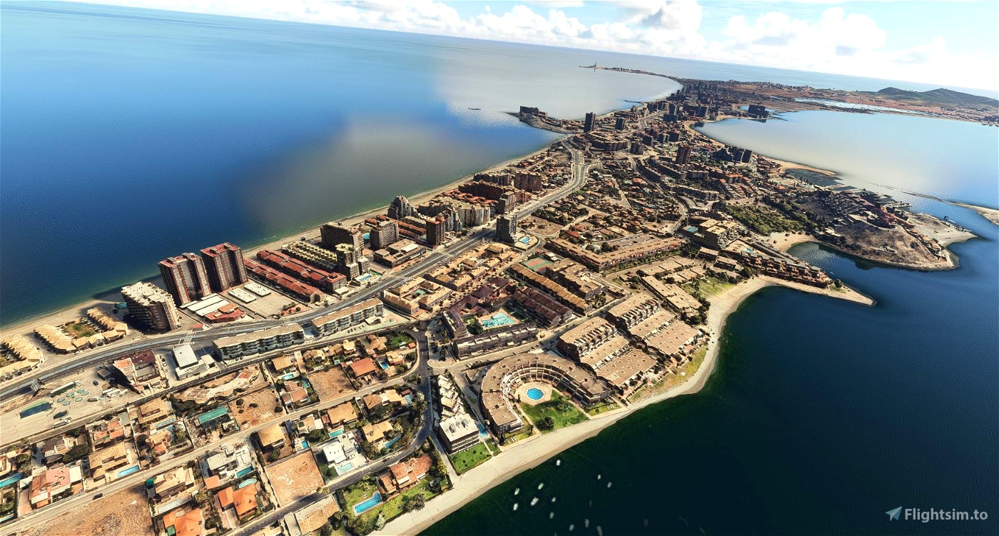
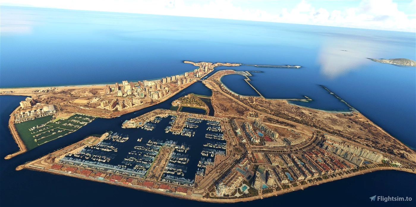
Scenery for La Manga del Mar Menor (Spain), based on Google Maps photogrammetry.
There are 2 files to download. Extract both in the community folder (there will be 8 subfolders after everything is extracted).
The loading time of the simulator will be quite long (more than 6 minutes, depending on the speed of your PC) when this scenery is activated, so please be patient.
Credits
Jonahex111 (Goolge Earth Decoder)
thalixte (Optimization tool for Google Earth Decoder)
Google Maps
Wikipedia information for La Manga:
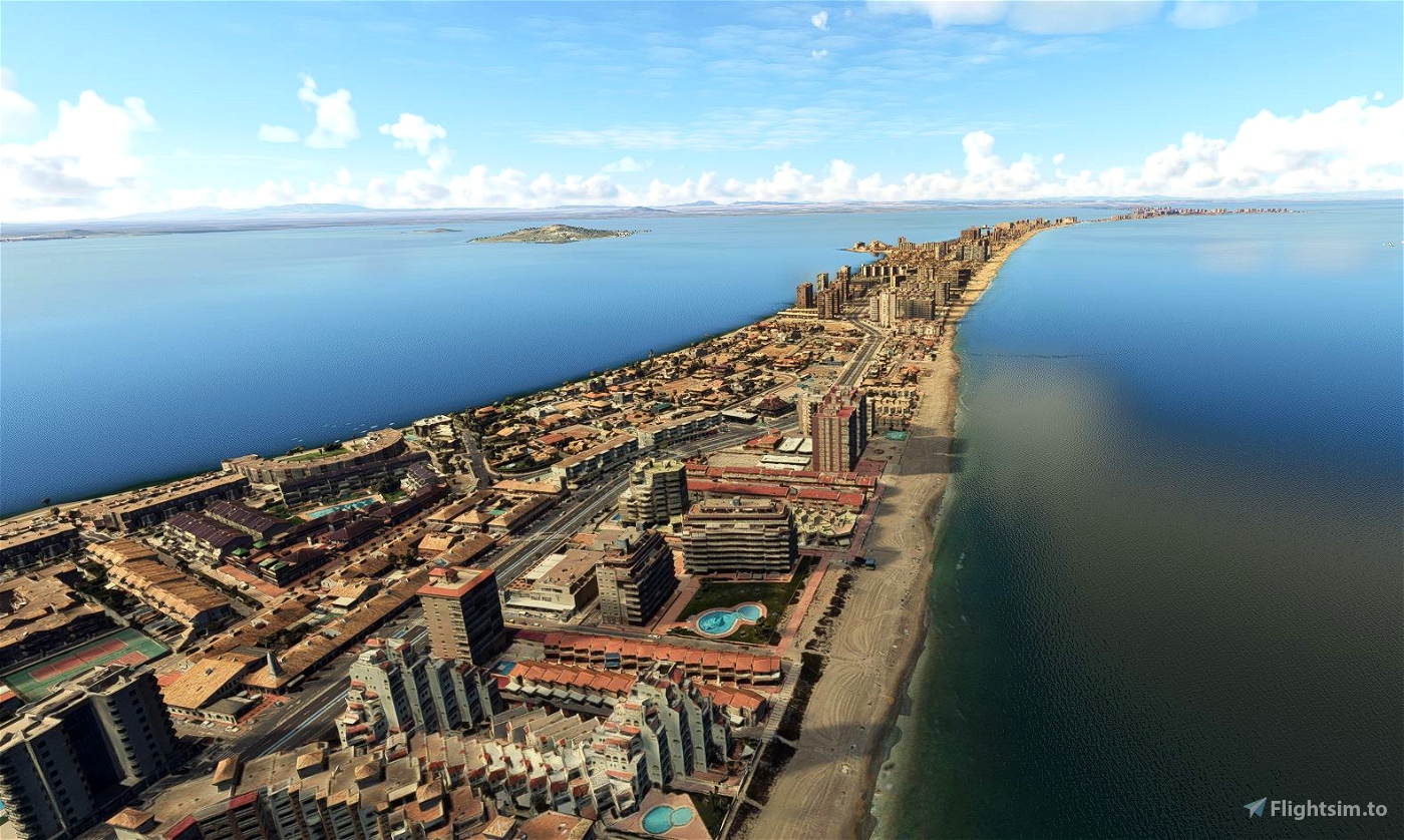
La Manga is a land strip with beaches on both sides in the Region of Murcia, Spain.
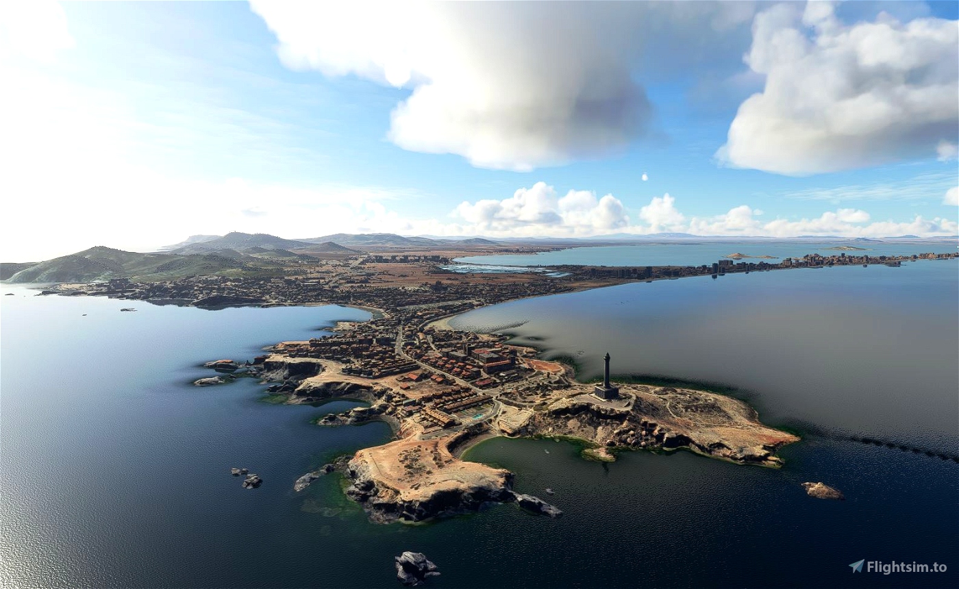
The strip is 21 km long and 100 metres wide (average), separating the Mediterranean Sea from the Mar Menor (Minor Sea), from Cabo de Palos to the Punta del Mojón.
Historically, it was known by the Romans as Palus and later by the Moors as Al Buhayrat Al Qsarand. In the 17th century its name changed to Mar Chico, meaning "small sea" and later as El Mar Menor. Originally, it was a bay opening into the Mediterranean; at either end, volcanic reefs gradually held back the sand and sediment that was dragged along by the sea currents to form a sandy column of dunes and rock vegetation and long beaches in contact with two seas. La Manga sandbar is cut off by natural channels that keep the two seas in contact with each other; the so-called golas allow water from the Mediterranean into the lake. As such, the space was untouched until the 1960s, when La Manga was discovered as a tourist resort and underwent a transformation which included the urbanisation of the area and the construction of tourist infrastructures.
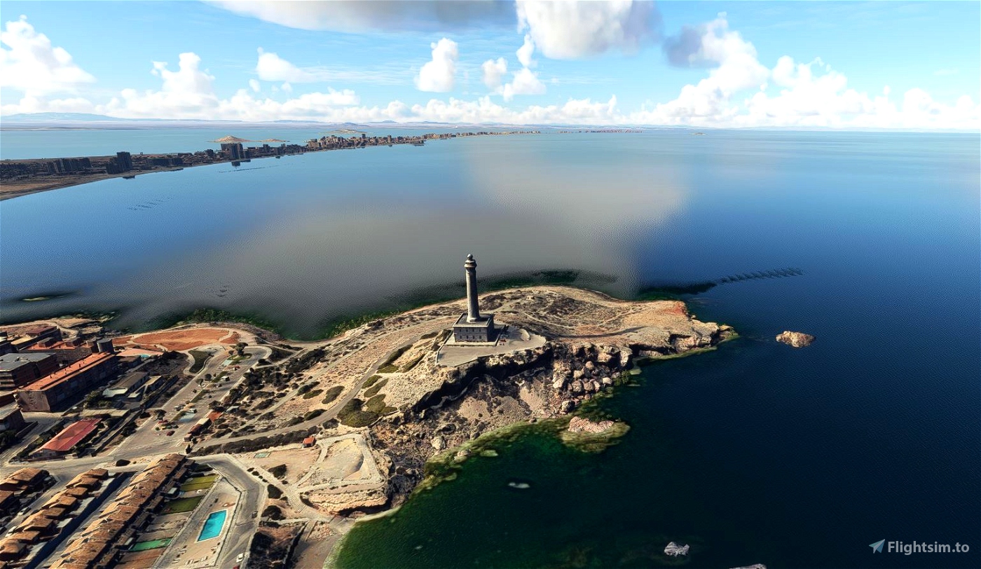
In 1938, during the Spanish Civil War, the Battle of Cape Palos took place near the cape. Its lighthouse began operating on January 31, 1865. The cape is part of a marine reserve, the Reserva Marina de Cabo de Palos and Islas Hormigas.


pastelin
downloading right now! a must because i am from cartagena
Descargando ya mismo, es para mi un deber tener este addon ya que soy de cartagena. Aprovechando el addon una reivindicación #SOSmarmenor
aduboy author
Apoyo el #SOSmarmenor. Esperemos que la situación mejore pronto.
3 years ago
leighhobson89
Nice scenery! I made a helicopter tour of it here, the photogrammetry starts about 2:50 in.
https://www.youtube.com/watch?v=EHfjiGrg0aY
aduboy author
Thank you very much for this great video! You made some very beautiful views with the helicopter flying.
You've got a new subscriber for your channel!
3 years ago
LAFter900
i also saw that to the end of La manga the building are generic and not custom buildings.
LAFter900
hi I am flying with this right now and I have a couple of issues with it 1. the cape Palos lighthouse is not 3d. 2. there are no cars on the roads and why can u go though buildings / ground. 3.at the beach the ocean look like a tsunami at cape Palos. other than that my house was there and all was good. my request is to make the port with real msfs water and ships 3d. Thanks for this addon
tkory9890
Great job in the detail of the buildings.
LAFter900
omg im defently geting this im in shok i live there!
aduboy author
Gracias!. I hope you can find your home detailed when you fly in this scenery!
3 years ago