


SKLT – Leticia Alfredo Vasquez Cobo Airport Scenery and Aerial Imagery – Version 1.0
MSFS’s stock Leticia’s airport doesn’t resemble reality. This scenery and the satellite imagery included
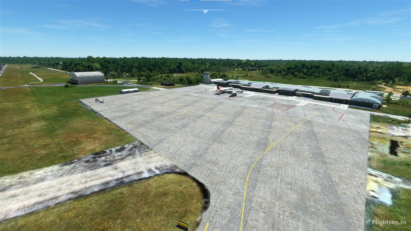
was created to have a more realistic and flyable airport for this region of Colombia. The scenery uses all
generic buildings, but an effort was made to make them look close to what the new terminal looks like in real
life. The military apron in the north of the airport is also modeled. Custom satellite imagery from Google
is included as well to give it a better feel and a more recent look. The scenery has not been tested without
the new aerial imagery. Additionally, a GSX profile is included for the 4 passenger gates.
Features:
• Gates 1-4, parking spots 5-7, and the military apron parking spots are modeled
• Aerial imagery from Google is included to replace the original Bing imagery – Not tested without it
• Runway includes the displaced threshold and the profile described in the Colombian AIS for SKLT.
• GSX profile included with custom vehicle placement, pushback spots, and with passenger walkers to the terminal during boarding and deboarding operations.
Installation:
1. Extract the .zip file
2. For GSX users that wish to use the GSX profile included: move the .ini file to
%APPDATA%\Virtuali\GSX\MSFS. The .ini file is found in the GSX folder
3. Move the ‘sklt-aerial’ and ‘airport-sklt-leticia’ to your community folder
4. That should do it.
Disclaimer: This scenery was created for personal use and was not originally intended to be uploaded, so
there might be some bugs present that may have been missed.
Happy Flights!
JCPR
--------------------------------------------------------------------------------------------------------------------
Español:
SKLT – Leticia Aeropuerto Alfredo Vásquez Cobo e Imágenes Satelitales – Versión 1.0
El aeropuerto de Leticia original que incluye MSFS deja mucho que desear y no concuerda con la
actualidad de esta terminal aérea. Este escenario y la imagen satelital incluida se crearon en un esfuerzo
de tener una versión mas realista y operativa de este aeropuerto en esta región de Colombia. El escenario
usa edificios genéricos, pero se trató de hacerlos ver lo mas parecidos a la terminal nueva del aeropuerto.
También se modelo rampa militar al norte del aeropuerto. Imágenes satelitales de Google de la terminal
se incluyeron para darle un mejor atractivo al escenario. El escenario no ha sido probado sin esta
imagen satelital. Así mismo, se incluye un perfil de GSX para las 4 puertas de pasajeros.
Características:
• Puertas 1-4, parqueadero 5-7, y la rampa militar han sido modeladas
• Imágenes satelitales de Google se incluyen para reemplazar las de Bing – se hizo un esfuerzo para
integrarlas con la imagen satelital original para que no haya una transición tan fuerte entre Bing y
Google – el escenario no se ha probado sin esta imagen satelital.
• La pista incluye el umbral desplazado y el perfil descritos en la AIS publicada por la Aerocivil Colombia
• Perfil de GSX con posiciones de vehículos personalizadas, remolque personalizado, y caminos de
pasajeros desde los aviones a la terminal
Instalación:
1. Extraiga el archive .zip
2. Para los usuarios de GSX que quieran usar el perfil de GSX incluido, colocar el archivo ‘.ini’ en
%APPDATA%\Virtuali\GSX\MSFS. Ese archivo se encuentra en la carpeta GSX
3. Coloque la carpeta ‘sklt-aerial’ y ‘airport-sklt-leticia’ en el ‘Community folder”
4. Eso es todo
Nota: Este escenario se creo originalmente para uso personal sin la idea de subirlo para descargas. Por
ende, puede que haya ‘bugs’ presentes que se hayan podido olvidar.
¡Felices vuelos!
JCPR
