Description:
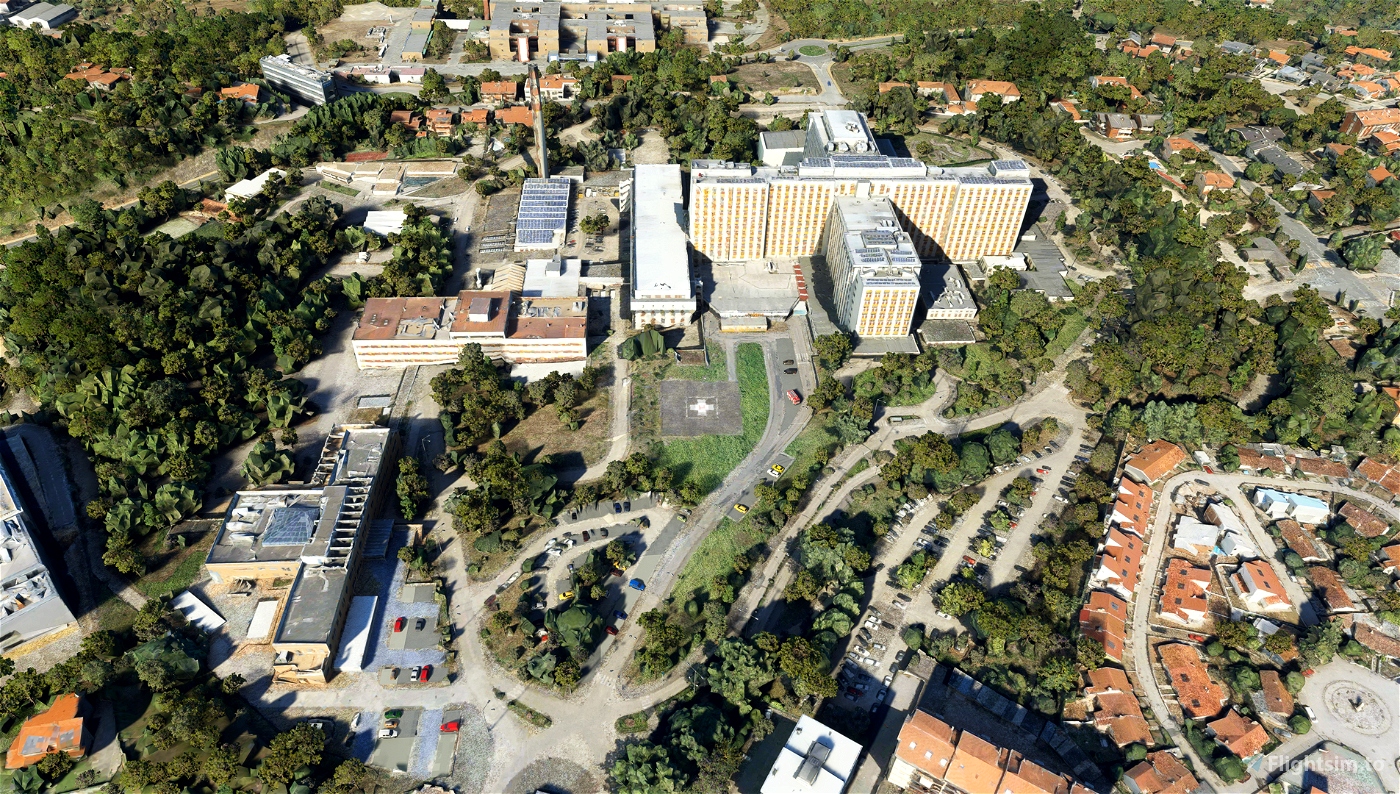
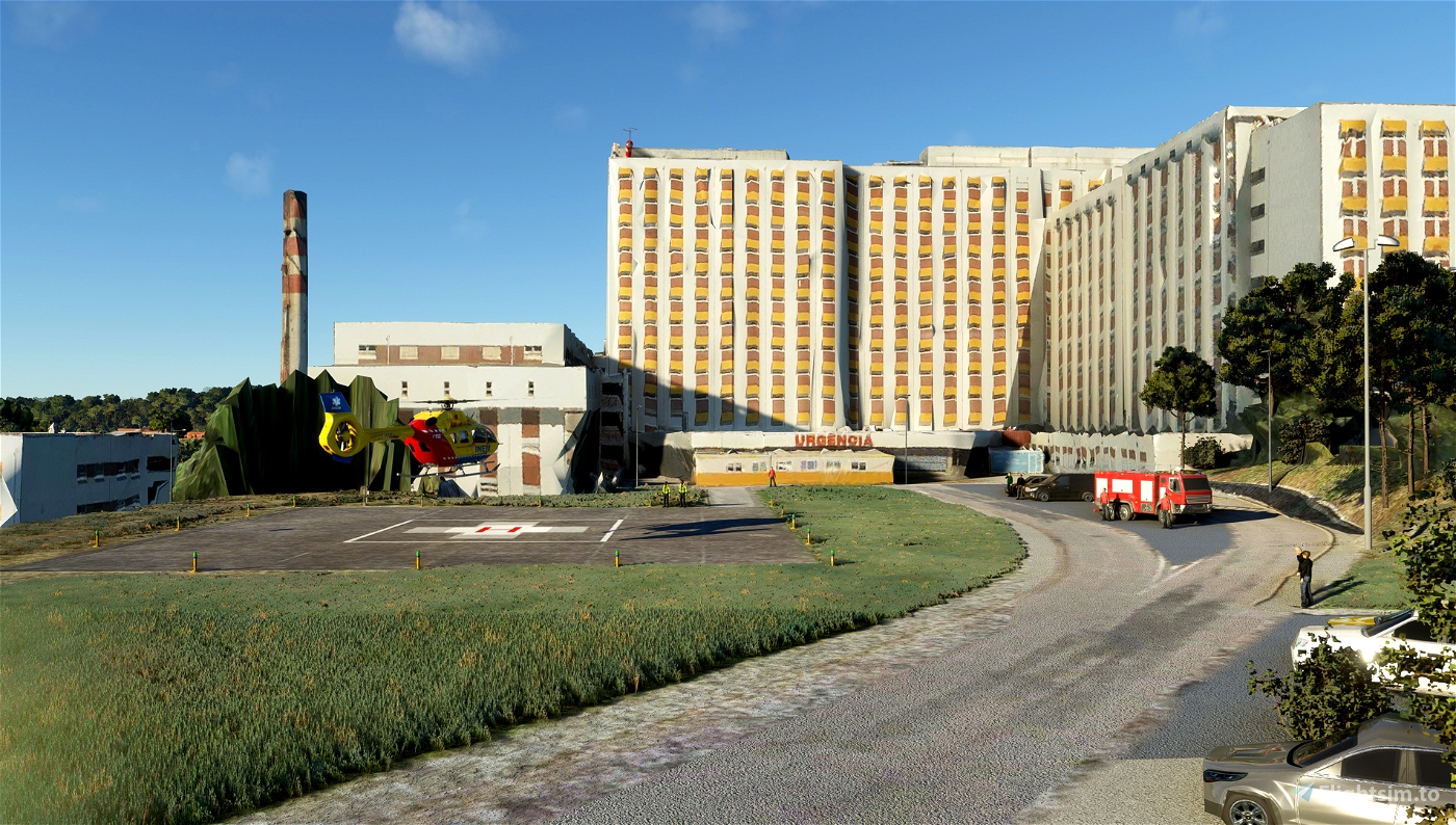
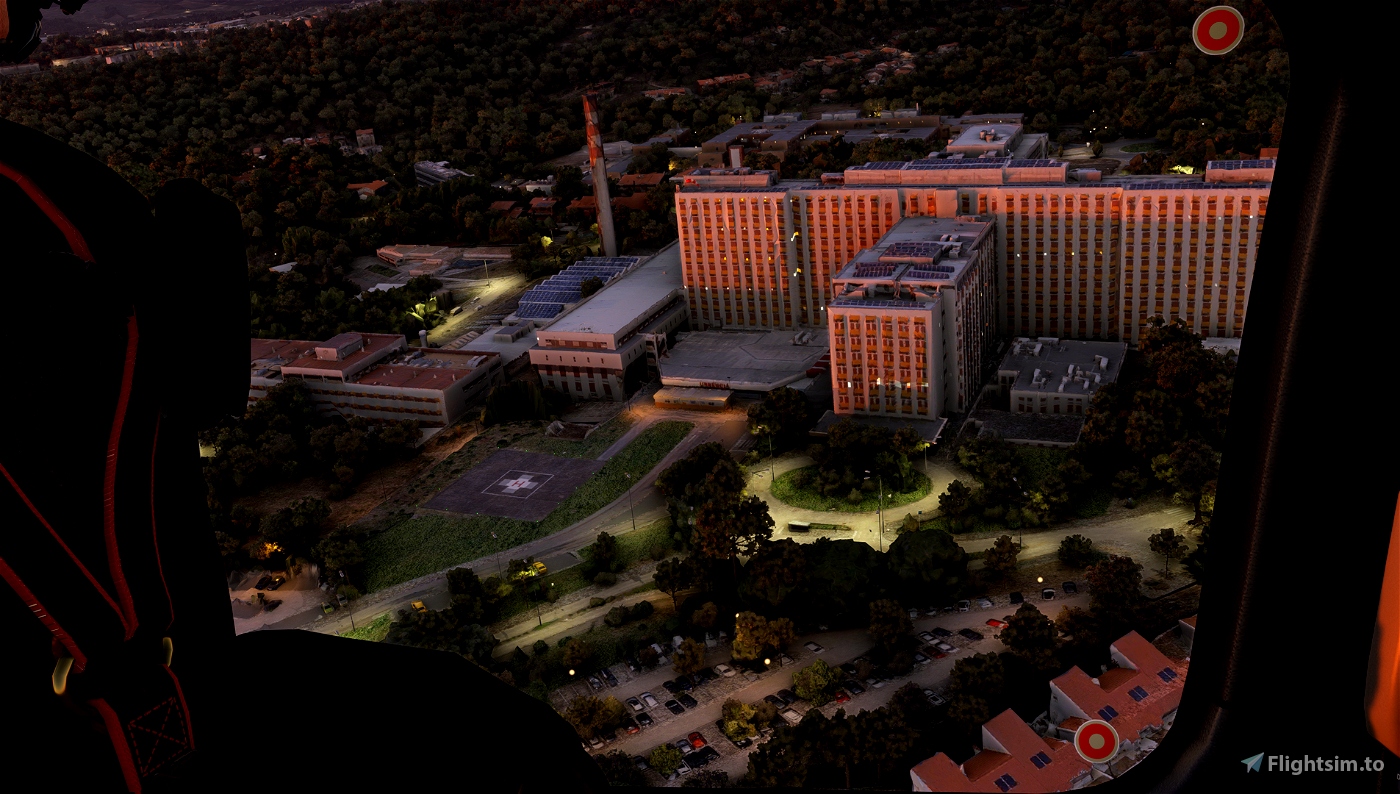
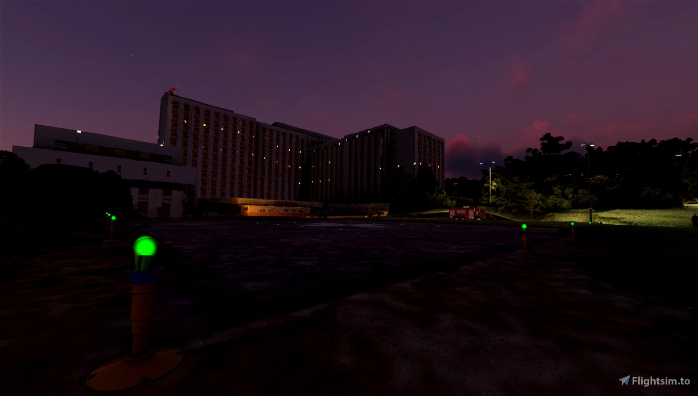
Coimbra Hospital and University Centre helipad with basic infrastructure and functionality:
- Terraforming.
- Elevation.
- Magnetic declination.
- Helipad FATO area illumination.
- Helipad TLOF area illumination.
- Hospital area street illumination.
- Most hospital area car parks.
Details:
- ICAO: LPCI.
- Latitude: 40-13-11.5572N (40.219877).
- Longitude: 008-24-46.8324W (-8.413009).
- Elevation: 331 feet MSL (101 m MSL).
- Magnetic Declination: 1.3 W (as of February 2023 from WMM2020 model).
- Time Zone: UTC +0.0 (Standard Time); UTC +1.0 (Daylight Savings Time)
- Airport Status: Operational.
- Type: Heliport.
- Traffic Pattern Altitude (MSL): 1331 feet (406 m).
Installation:
Unzip the archive into your "Community" folder.
Requirements:
None.
Compatibility:
World Update VIII: Spain, Portugal, Gibraltar and Andorra.
Author intentions:
This project is meant to add a functional helipad to Coimbra's Hospital and University Centre (CHUC), and update the entire hospital area with all the car parking areas, vegetation areas, roads, and modeled infrastructure. So far, helipad functionality, a few car parking areas and night lighting have been accomplished.
User intentions:
If you'd like to see a custom modification on this scenery, send me a message and I'll see what I can do.
Note:
As this is my first scenery, please feel free to leave your feedback or comment on how I can improve it.


amazing !
any possibility hospital de cascais ? Cheers
1 years ago
Hi captainrafael, thank you very much for your comment!
There's a possibillity, yes.
Take care.
1 years ago
MillWind
captainrafael
Is it compatible with Coimbra scenery by Thaxlixte?
1 years ago
Hi harpsi. Work is being done to provide that feature.
1 years ago
MillWind
harpsi