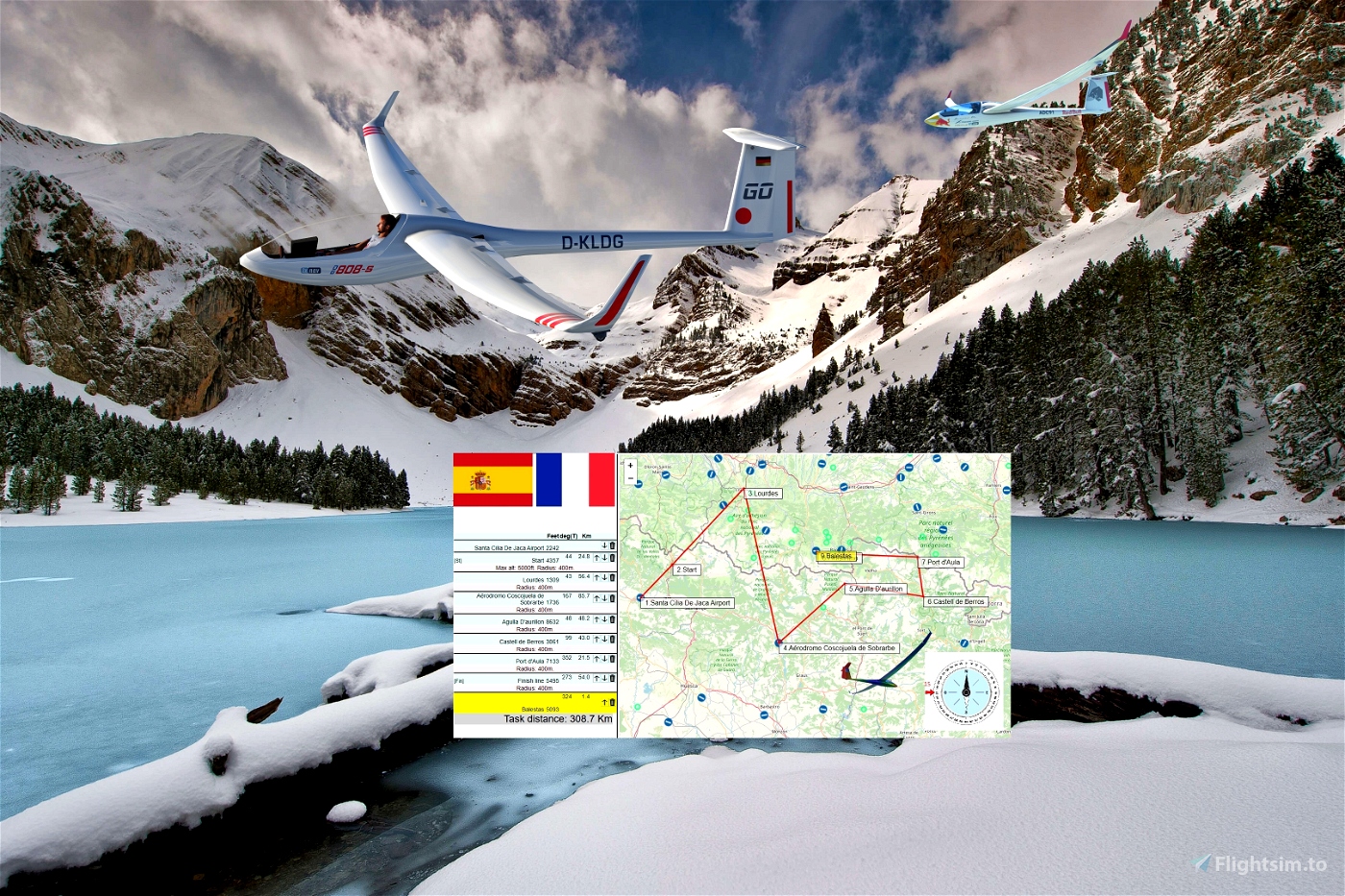
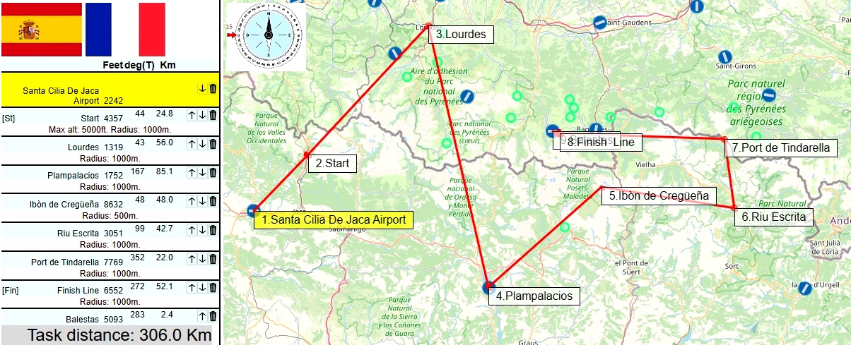
Distance:305km.Length:1.30-2:15h .
Difficulty:Medium .....
Departure: LECI Santa Cilia De Jaca Airport Spain
Arrival: LFIP Balestas France
Soaring Type: Ridge
Notes:
MAX START HEIGHT as in task is 5200 feet (1220 meters). As reminder, start WP is labelled "Start 5200".
autor map and weather : Georg Ortner from SCC Sim Soaring Club
----
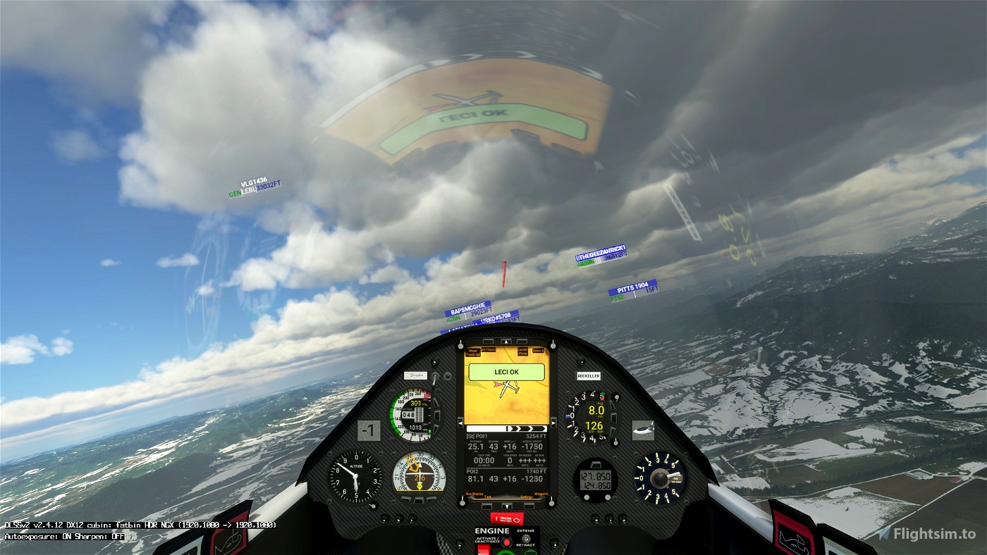
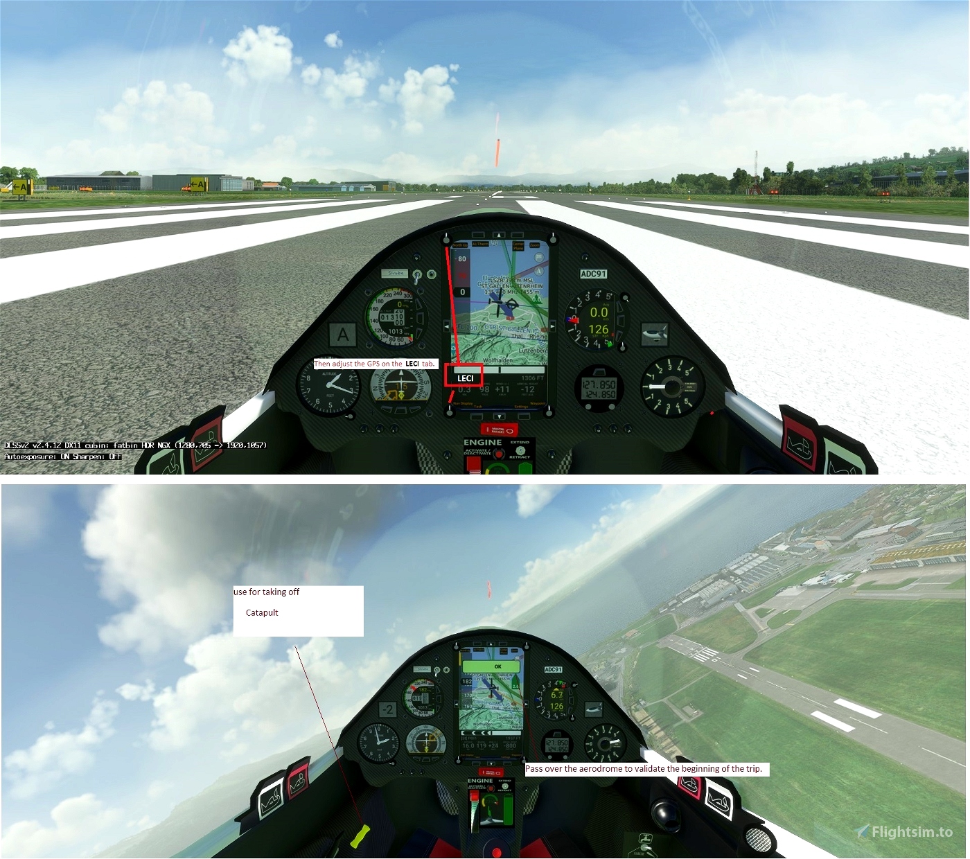
Use and look to GPS to validate all crossing points (notification when done).Watch your GPS and wait for the map to finish loading.
Then adjust the GPS on the LECI tab .
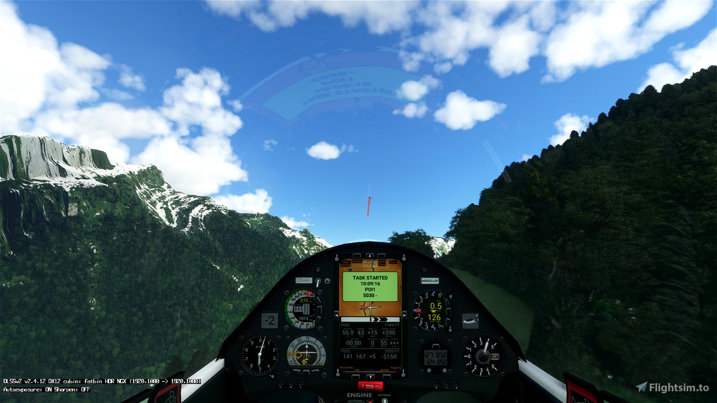
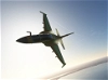
Start your engine to reach 5 200 feet.
Pass over the aerodrome to valid LECI
Make sure that you have validated the crossing point above the aerodrome.
5200 FEET Maximum height to pass the POI1 start line.
---------------
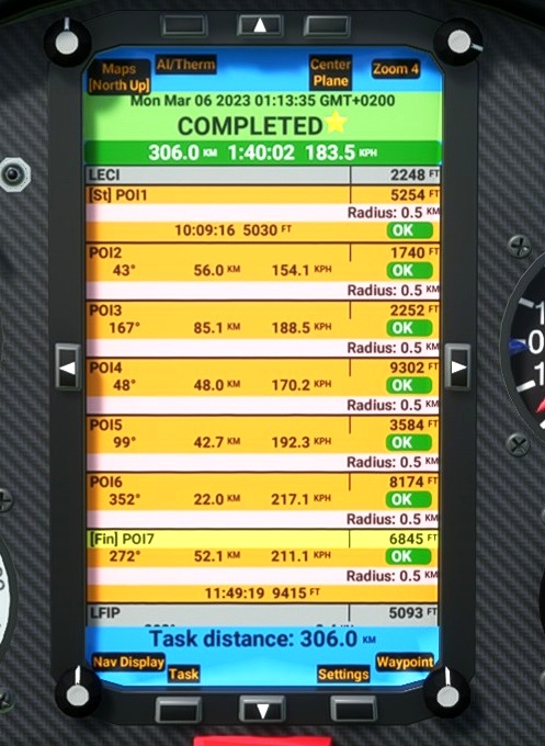
LECI Santa Cilia De Jaca Airport 2242
OK go to POI1: Starting line. Elevation 5200 FEET maxi
OK go to POI2: Lourdes Elevation 1319feet
OK go to POI3: Plampalacios Elevation 50932 feet
OK go to POI4: Ibòn de Cregüeña Elevation 8632 feet
OK go to POI5: Riu Escrita. Elevation 3051 feet
OK go to POI5: Port de Tindarella. Elevation 7769 feet
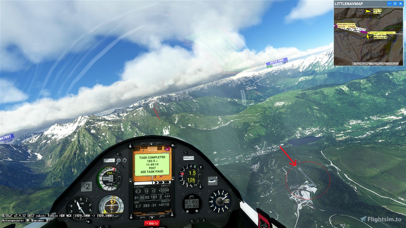
OK go to POI5: Finish line. Elevation 6552 feet
Landing on the airport of Balestas - LFIP 5093 feet.
Turn off your main battery after landing and wait to get the trip completed message.
----------------------------
MADoloSimulations
ASS33 me
https://fr.flightsim.to/file/15090/as-33-me
SCC Sim Soaring Club GeorgOrtner
https://discord.com/invite/8TaW8QjH
https://www.twitch.tv/videos/122424299342
https://www.youtube.com/GeorgOrtner
https://www.instagram.com/simsoaringclub/
https://discord.com/invite/8TaW8QjH
--------------------------------------------------

 ADCKillerman


Thank You!
10 months ago
Ginete